


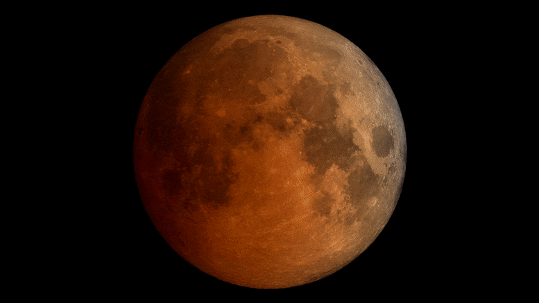
La aparición de la luna durante un eclipse lunar total en noviembre de 2022. La NASA ha publicado un nuevo mapa que detalla los eclipses solares en 2023 y 2024 en los Estados Unidos. Crédito: Estudio de Visualización Científica de la NASA
¿Dónde estarán los eclipses solares en 2023 y 2024 en Estados Unidos?
Based on observations from several NASA missions, the map details the path of the Moon’s shadow as it crosses the contiguous U.S. during the annular solar eclipse on October 14, 2023, and total solar eclipse on April 8, 2024.

Using observations from different NASA missions, this map shows where the Moon’s shadow will cross the U.S. during the 2023 annular solar eclipse and 2024 total solar eclipse. The map was developed by NASA’s Scientific Visualization Studio (SVS) in collaboration with the NASA Heliophysics Activation Team (NASA HEAT), part of NASA’s Science Activation portfolio. Credit: NASA/Scientific Visualization Studio/Michala Garrison; eclipse calculations by Ernie Wright, NASA Goddard Space Flight Center
These dark paths across the continent show where observers will need to be to see the “ring of fire” when the Moon blocks all but the outer edge of the Sun during the annular eclipse, and the ghostly-white outer atmosphere of the Sun (the corona) when the Moon completely blocks the Sun’s disk during the total eclipse.
Outside those paths, the map also shows where and how much the Sun will be partially eclipsed by the Moon. On both dates, all 48 contiguous states in the U.S. will experience at least a partial solar eclipse (as will Mexico and most of Canada).
Reading the Map
On NASA’s new eclipse map, the paths for the annular eclipse and total eclipse appear as dark bands across the U.S.
Anyone located in the annular eclipse path, from Oregon to Texas, will have a chance to see the annular eclipse if the skies are clear. Anyone located in the total eclipse path, from Texas to Maine, will have a chance to see the total eclipse, weather permitting.

An area of Texas near San Antonio, where the two eclipse paths cross, will experience both the annular eclipse in 2023 and the total eclipse in 2024. Credit: NASA/Scientific Visualization Studio/Michala Garrison; eclipse calculations by Ernie Wright, NASA Goddard Space Flight Center
Inside those dark paths are oval shapes with times inside them (yellow ovals for the annular eclipse, purple ovals for the total eclipse). Those ovals show the shape of the Moon’s shadow cast on Earth’s surface at the times shown. People in the areas inside the ovals will see the annular eclipse or total eclipse at that time.

The Moon’s shadow will move quickly during both eclipses. On the map, ovals within the eclipse paths show the location and shape of the shadow at different times. For example, during the total eclipse on April 8, 2024, the Moon’s shadow will be over Dayton, Ohio, at 3:10 p.m. EDT, but by 3:20 p.m. EDT it will have moved to Buffalo, New York. Credit: NASA/Scientific Visualization Studio/Michala Garrison; eclipse calculations by Ernie Wright, NASA Goddard Space Flight Center
For locations close to the center of the paths, the annular eclipse or total eclipse will last longer than those near the outer edges of the path. Inside each path are white lines that indicate how long annularity or totality will last. For the annular eclipse path, you can find labels (ranging from 3 to 4.5 minutes) near the Nevada-Utah border in the north and between San Antonio and Corpus Christi, Texas, in the south. For the total eclipse path, you can find labels near Presque Isle, Maine, in the north, and between the 2:20 and 2:25 p.m. CST ovals in Mexico in the south.

The closer to the center of the eclipse path, the longer each eclipse will last. On the map, each eclipse path includes white lines that indicate how long that eclipse will last at different locations. For example, the annular phase of the eclipse will last about four minutes near Elko, Nevada, and about four and a half minutes near Richfield, Utah. Credit: NASA/Scientific Visualization Studio/Michala Garrison; eclipse calculations by Ernie Wright, NASA Goddard Space Flight Center
Viewers in locations outside the paths will not experience a total solar eclipse or annular eclipse, but they may still see a partial eclipse. Lines running parallel to each path indicate how much of the Sun will become covered by the Moon during the partial eclipse. For the annular eclipse, these lines appear faint yellow. For the total eclipse, they’re faint purple. Percentage labels for the annular eclipse lines appear along the left and top edges of the map. The percentage labels for the total eclipse appear along the bottom and right edges of the map. (Tip: The percentages appear at the same angles as the lines.)

Outside of the eclipse paths, purple and yellow lines on the map show the percentage of the Sun that will become covered by the Moon at different locations for the total and annular eclipses, respectively. For example, the purple line that passes near New York City and Providence, Rhode Island, indicates that the Sun will become about 90 percent obscured in those cities during the peak of the eclipse on April 8, 2024. Credit: NASA/Scientific Visualization Studio/Michala Garrison; eclipse calculations by Ernie Wright, NASA Goddard Space Flight Center
Neither eclipse will be contained to the contiguous U.S., though. In the lower right corner of the NASA map, a globe shows the full paths for both eclipses. The annular eclipse (in yellow and black) extends into Mexico, Central America, and South America. The total eclipse (in purple and black) also crosses Mexico and northeastern Canada. Shaded bands (yellow for the annular eclipse and purple for the total eclipse) also show where a partial eclipse can be seen. For example, in October 2023, southeastern Alaska will experience a partial eclipse, while Hawaii will have a chance to see a partial eclipse in April 2024.
Making the Map
Michala Garrison, a member of the Scientific Visualization Studio (SVS) at NASA’s Goddard Space Flight Center, applied her background in geography and cartography to design the map, incorporating information from a variety of NASA sources.
Earth elevation information came from the Shuttle Radar Topography Mission, while maps of the Moon’s shape were supplied by Lunar Reconnaissance Orbiter. The positions of the Sun, Moon, and Earth were found using software and data from NASA’s Navigation and Ancillary Information Facility. Garrison’s SVS colleague, Ernie Wright, used all of this information to calculate the location and shape of the Moon’s shadow.

The NASA map includes a globe showing the full paths of the 2023 annular eclipse (in yellow and black) and the 2024 total eclipse (in purple and black). Shaded bands (yellow for the annular eclipse and purple for the total eclipse) also show where a partial eclipse can be seen. Credit: NASA/Scientific Visualization Studio/Michala Garrison; eclipse calculations by Ernie Wright, NASA Goddard Space Flight Center
NASA’s Blue Marble – a global mosaic of satellite images assembled by the NASA Earth Observatory team – provided color for the land. And one particularly unique feature Garrison thought to add along the path of the 2024 total eclipse was nighttime imagery of Earth from NASA’s Black Marble – which shows city lights on the night side of the planet as imaged by the Suomi NPP spacecraft.
One of Garrison’s goals for the map was to inspire people to get to the paths of the annular and total eclipses, which she didn’t do the last time the Moon’s shadow crossed the continental U.S.
Dos eclipses solares cruzarán los Estados Unidos en 2023 y 2024. El 14 de octubre de 2023, un eclipse solar anular creará un «anillo de fuego» en el cielo desde Oregón hasta Texas. El 8 de abril de 2024, un eclipse solar total oscurecerá los cielos desde Texas hasta Maine. En ambas fechas, los 48 estados contiguos de los Estados Unidos verán un eclipse solar parcial. El mapa, desarrollado utilizando datos de una variedad de fuentes de la NASA, muestra tanto las trayectorias de los eclipses como bandas oscuras. Fuera de estos caminos, las líneas amarillas y violetas muestran cuánto bloqueará la Luna del Sol durante un eclipse parcial. Este video se acerca a diferentes partes del mapa, mostrando estas y otras características que describen lo que los observadores de todo el país pueden esperar durante cada eclipse.
«En 2017, estaba en Maryland, así que tuve que ver un poco, porque estaba en un eclipse parcial», dijo. «Pero no sabía nada de eso en ese momento. Me dan ganas de ir, digamos, a Albuquerque en 2023. Y luego en 2024 ir más al sur».
Garrison trabajó en varias revisiones para tratar de hacer que el mapa fuera tanto estético como funcional, para ayudar a las personas dentro y fuera de los senderos a planificar su experiencia con el eclipse.
«Tomó mucho ensayo y error. Quería que fuera útil para el lector, pero no abrumador, y que siguiera siendo un gran producto para llamar la atención de la gente».

«Jugador. Wannabe evangelista de la cerveza. Practicante de la cultura pop. Amante de los viajes. Defensor de las redes sociales».
More Stories
Lucha para protegerte de la gripe aviar con láseres y bailarinas hinchables
Estudiantes de la UCF excavan el primer sitio de lanzamiento en el Cabo antes del 75 aniversario
Los mejores lugares para ver desde Volusia